The Story of the Wartime Kokoda Trail: Sorting Fact from Fiction
Peter Jesser
The battle for the Kokoda Trail occupies a significant place in Australian military history. Much of the fighting to stem the Japanese advance across the Owen Stanley Range was intense, close-quarter combat fought in thick jungle and on steep slopes. Frequent rain made conditions worse. The days were hot and steamy and the nights in the mountains could be bitterly cold. Troops on both sides were weakened by disease and illness. In the first battles, the Australians lacked the supplies or weapons needed to fight effectively. But after initial setbacks during which control of the track hung in the balance, the Australian and Papuan defenders prevailed—and a legend was born.
Because of its proximity to Australia, many Australians have come to view Kokoda as a key battle that turned the tide of war against Japan. That, and the significant physical and mental challenge presented by walking the track, have encouraged many individuals, both young and old, to complete the Kokoda Trail as a means of gaining a better understanding of what soldiers had to endure in 1942. That the conditions experienced today are nothing like those endured during the war is not the point. The Kokoda Trail has become a place of contemplation for walkers struggling across the same steep ridges and slippery log river crossings that their forebears did.
Various histories have been written which tell the story of Kokoda from different perspectives.
But as the battle for the track has taken hold in the public imagination, several new accounts of the conflict have been written to target wider audiences. Where they describe the track, these new accounts reflect less rigorous research. Several make baseless assumptions to support the argument as the writer wants to tell it. Increasingly, descriptions of the prewar track have relied on fictions invented by later authors and—regrettably—the inadequate or faulty research of professional historians.
This account will correct some common misperceptions about the knowledge in New Guinea [1], of the track from Port Moresby to Kokoda in early 1942, and will describe
the origins of the track and its evolution, drawing on reports dating back to the late nineteenth century.
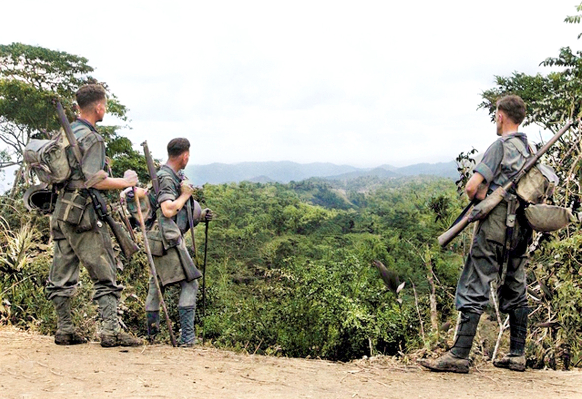
Australia soldiers look at the scenery from Eoribaiwa Ridge towards Kokoda, 1942
For the wartime track, this account will rely on the actions and recollections of the only men who can speak with authority—those who were there at the beginning.
Early Ventures into the Mountains
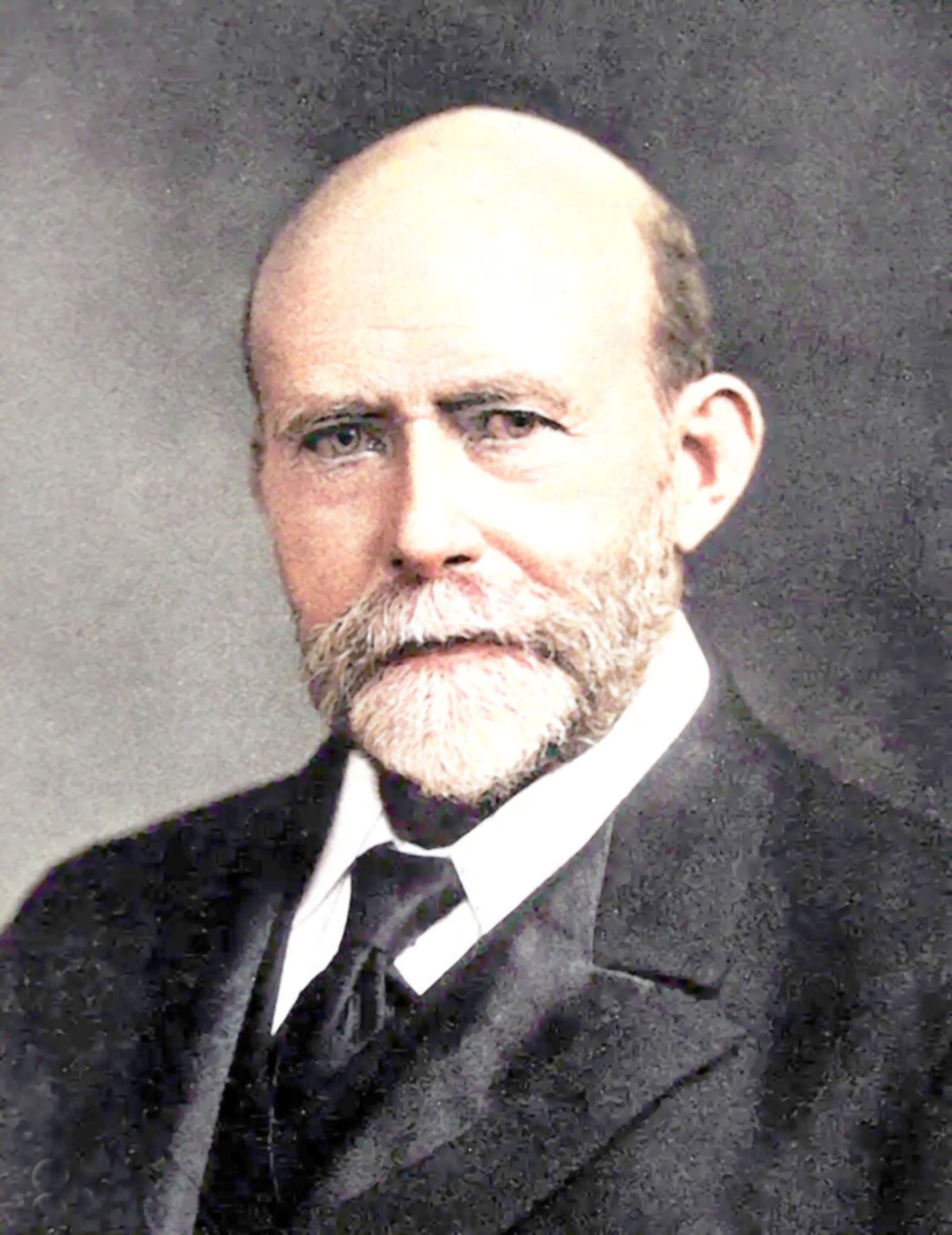
Sir William MacGregor GCMG, CB, AM, PC, FRSGS
The earliest European ventures into what would become British New Guinea (later to be known as the Territory of Papua) involved missionaries who were active along the coast. The London Missionary Society established a mission at Port Moresby Harbour under Reverend Doctor William Lawes in late 1874 [2]. Lawes was not an explorer, but he penetrated inland as far as the Bluff and did his utmost to establish amicable relations with the ‘natives’.
Lawes was followed in 1875 by the geologist, Octavius C Stone, who made several trips to the interior penetrating, perhaps, as far as Uberi [3].
In 1876–77, Andrew Goldie, a Scottish naturalist, arrived to collect botanical specimens. Goldie covered considerable ground and, in addition to botanical specimens, found unmistakable traces of gold in what he called the Goldie River—whether named for himself or the gold is not known [4]. Goldie appears to have been the first to penetrate any substantial distance inland from Port Moresby and he added to knowledge of both the mountain tribes and of the vegetation.
The news that traces of gold had been found encouraged further exploration and prospecting. No payable gold was found but definite views were formed as to the inhospitable nature of the mountains of the interior [5]. As a result, by the early 1880s, there was good knowledge of the areas that the Kokoda Trail would traverse.
Sir William MacGregor and the Vanapa Track
Sir William MacGregor [6] was the first Administrator of British New Guinea. MacGregor was a remarkable man more given to exploration than sitting behind a desk. He was intent on establishing law and order but also concerned that the ‘natives’ should be treated fairly.
One of his earliest ventures into the interior arose from a visit to the north coast to inspect the developing Yodda Valley gold prospects along the valley of the Yodda (Mambare) River around Mount Stapylton. Along the way, he dealt with a cannibal raiding party on the Mambare and then proceeded to cross the island from north to south—from the mouth of the Mambare to the mouth of the Vanapa River. This was the first such crossing by a European. The events of this expedition are recorded in the Annual Report on British New Guinea (1 July 1896 to 30 June 1897) [7].
As part of his journey, MacGregor made a deviation to climb the highest peak in the Main Range to more accurately ascertain its height. He approached the high point via Mount Musgrave and Mount Knutsford and named the peak Mount Victoria in honour of Queen Victoria. While making this ascent MacGregor observed:
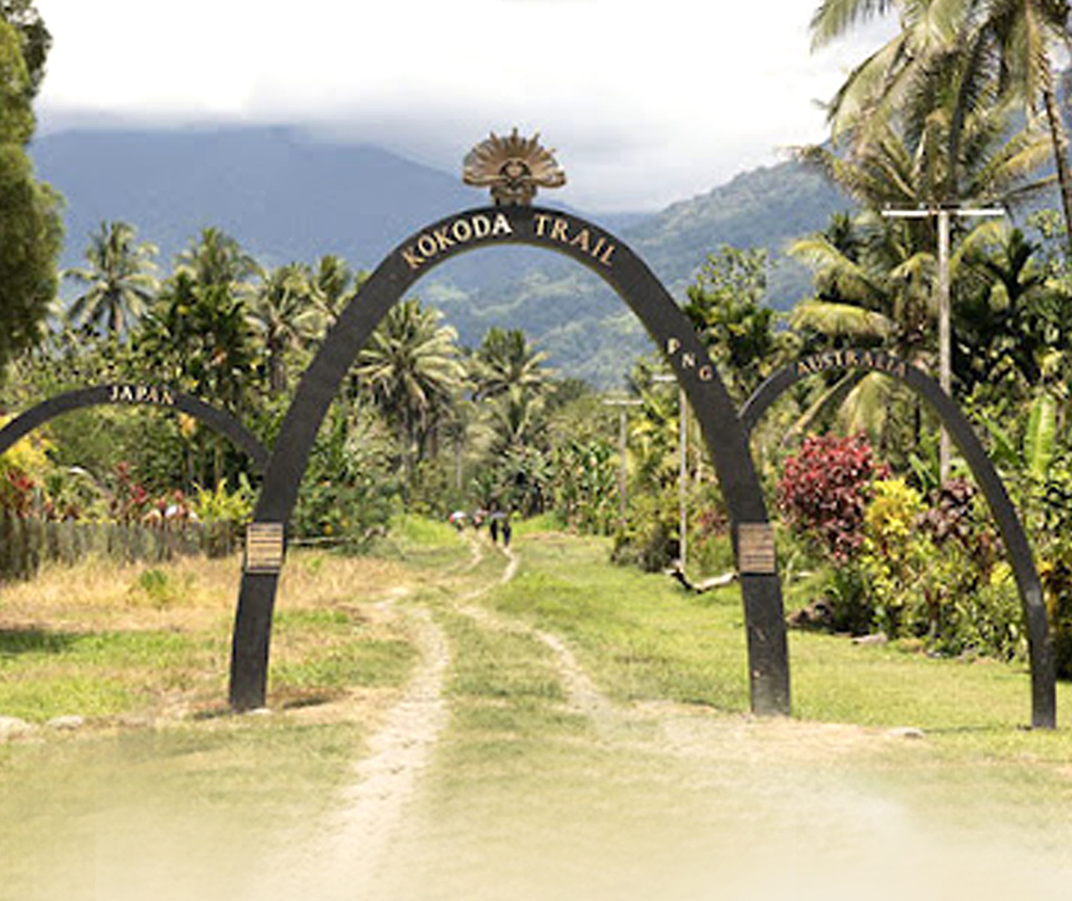
Entrance to the Kokoda Trail
From about 5,500 feet there was a good view to the gap or depression in the main range some ten or twelve miles east of Mount Victoria, but it did not seem to offer an inviting route by which to cross the mountain chain.[8]
MacGregor’s observation is revealing and confirms that no one had crossed the mountains from Port Moresby via the Gap and thus there was no first-hand knowledge of the topography. From the top of Mount Victoria, MacGregor also observed that there seemed to be a feasible route from Mount Knutsford to the south coast. This route MacGregor took, following the valley of the Vanapa River.
MacGregor’s party thereby completed the first crossing of the island. The trail that the party blazed would be referred to as the Vanapa Track, leading from the south coast into the Yodda Valley. MacGregor believed that prospectors using the track would have an easy journey of fifteen days, with the benefit of waypoints and shelters that he established for the use of travellers.
Later that year, about 400 hopeful would-be prospectors landed in Port Moresby. According to the Annual Report:
They travelled thence generally in three or four directions, on the Vanapa track, inland from Port Moresby, by the Rigo Station, and along the Angabunga river [sic—Angabanga]. In most instances they carried their own effects and tools, and in a very few days became quite unfit for the road. Unfortunately, most of them seemed unable to make for themselves suitable camping arrangements, … [most were] … ill-provided with food, and in too many cases with no medicines whatever.
The result was that after a very short time, large numbers became very weak and gave way to fever and dysentery.
Of some 130 men that started inland on the Vanapa track, the majority did not get past the Evelyn Creek, two days inland from Doura. Only two small parties from the South Coast seem to have reached the eastern side of Mount Scratchley and they consisted of or were conducted by, men already accustomed to travel in the country.[9]
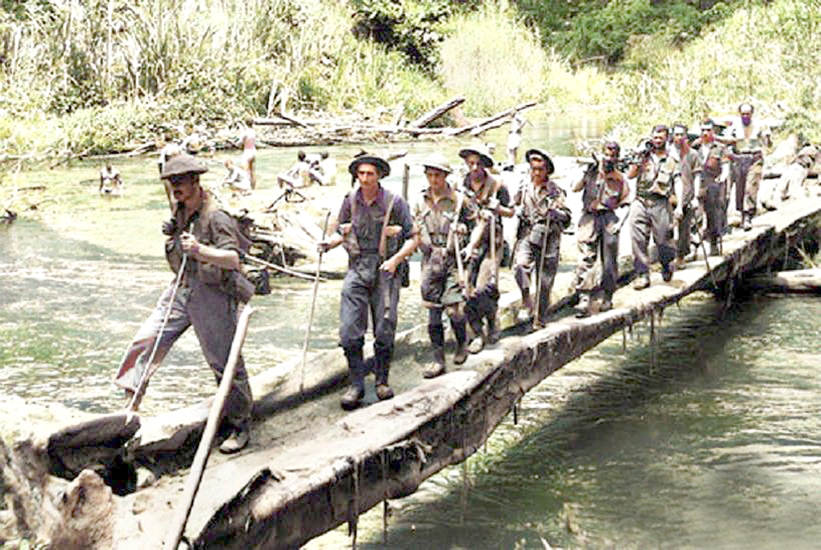
Australian infantry patrol crossing the Brown River, during the Kokoda Campaign, 1942
MacGregor was left to lament that almost all the prospectors ignored the track and the shelters provided to assist them. Instead, they took to the bush in the hope of finding new prospects. None succeeded. Several died subsequently of illness and most of the remainder gave up, beaten by the country. But the situation in 1897 was that—for those willing to use it—the Vanapa Track, which had been established by the Administrator of the Territory, offered a way across the mountains to the Yodda goldfields. No other track existed in closer proximity to Port Moresby. MacGregor’s observations on the difficult nature of the terrain in the vicinity of the Gap, where any alternative track would likely run, is notable.
This was the situation as demonstrated by official records. But in 2003 historian, Hank Nelson, made the astonishing claim that the ‘Kokoda track’ was first used by Australians in the 1890s to reach the Yodda goldfields [10]. Nelson cited no references to support this claim, but in his earlier (1976) book, Black, White and Gold, he stated that, by 1897, of several hundred men who set out for the goldfields from Port Moresby, only two parties made it across the mountains [11]. Nelson’s association of this with a supposed ‘Kokoda track’ seems to be nothing more than a loose appropriation of MacGregor’s official report which referred to the Vanapa Track. The lack of references is an indication of the worth of Nelson’s claims.
NOTES
- The country which is today called Papua New Guinea comprised the Territory of Papua and the Territory of New Guinea in the years prior to World War II. However, under military rule, from early 1942 it was referred to simply as New Guinea. This book will follow the war-time convention of referring to the theatre of war as New Guinea, except where it is necessary to make a distinction between the Territories of Papua and New Guinea. (Hank Nelson, ‘Report on historical sources on Australia and Japan at war in Papua and New Guinea, 1942-45’. Read more HERE.
- Hawthorne, Stuart, The Kokoda Trail: A History, Central Queensland University Press: Rockhampton (2003), pp.1–17. Lawes was preceded by four Polynesian missionaries who had established themselves at the nearby village of Hanuabada.
- Ibid., p. 4.
- Town and Country Journal, 1 February 1879.
- The Sydney Mail, ‘Gold Prospecting in New Guinea’, 10 August 1878. The Mercury Supplement (Hobart),‘Recent Exploration and Discoveries in British New Guinea’,
14 January 1892.
- See William MacGregor—Wikipedia for a concise biography of the first Administrator of British New Guinea (which later became Papua).
- Annual Report on British New Guinea, 1 July 1896 to 30 June 1897, (with Appendices), 1898.
- Ibid., p. xii.
- Ibid., p. xviii.
- Nelson, Hank. ‘Kokoda: The Track from History to Politics’, Journal of Pacific History, 38 (1), (2003), pp. 109-127.
- Nelson, Hank, Black White and Gold, Australian National University Press: Canberra (1976), pp. 115-6.
Editor’s Note: This article is an excerpt from the PIB NGIB HQ PIR Association website and can be read in full here. It is reproduced in two parts in the June and September issues of PNG Kundu with the author’s permission. Featured on the back cover of this issue is a report on the historic walk of the Australian Prime Minister on the Kokoda Trail for Anzac Day 2024.
To Be or Not to Be? Track or Trail?
The military historian Dr Karl James was commissioned by the Department of the Environment, Water, Heritage and the Arts (DEWHA) in 2009 to undertake a historical desktop study titled: ‘The Track’—a historical desktop study of the Kokoda Track’. It’s worth reading here.
Following is an excerpt from an article Dr James subsequently wrote for the Australian War Memorial:
In recent years, many hours have been wasted and much ink has been spilt debating whether the foot route across the Owen Stanley Range, in Papua New Guinea, should be called the ‘Kokoda Trail’ or the ‘Kokoda Track’. Both terms were used interchangeably during the war, and at the time they were not considered to be mutually exclusive.
Now, though, as Kokoda takes on an ever-increasing prominence in Australia’s military pantheon, second only to Gallipoli in the nation’s sentiment, the ‘track’ versus ‘trail’ debate has become an impassioned, and at times almost belligerent, argument. Supporters of ‘Kokoda Track’ object to the use of the word ‘trail’ on the grounds that it is considered to be an American word, whereas ‘track’ is strongly associated with the language of the Australian bush.
Those who favour ‘trail’ are quick to point out that the ‘Kokoda Trail’ is the official title of the Australian Army’s battle honour, the name gazetted for the route by the Papua New Guinea (PNG) Government and the name used by the Australian War Memorial.