Crossing the Saruwageds, Easter 1976 – Part Three
Ian Howie-Willis
Part Two of this three-part series described how the author and his three Papua New Guinea University of Technology (Unitech) companions tried to find their way down the northern side of the Saruwaged Range north of Lae. This final instalment describes how they reached safety in a hospitable village on the northern side of the range. It concludes by pointing out that the tough and demanding routes across the range still claim the lives of unwary travellers.
After Robin King, Matt Linton, Hector Clark and I reached the first of the villages on the northern side of the range after more than 11 hours on the track, the villagers showed us to the Haus Kiap, where we would spend the night. They lit a fire for us and brought us a kettle of boiling water for cups of tea. They also brought us a generous meal of kaukau (sweet potato).
When the kaukau arrived, steaming in its pot, I thought it was the most satisfying meal I had ever eaten. With the kaukau came dozens of villagers. Somehow, they all managed to squeeze into the Haus Kiap, sitting around the fire with us for an evening of planti toktok (much conversation).
Their first question was who on earth we were. We said we were teachers from Unitech in Lae. They nodded wisely because they knew what that was.
Next question: why had we come to their village? ‘Mipela laik wokabaut tasol, long ol naispela maunden bilong yupela’ (We just like hiking around your beautiful mountains). We explained further that we had flown into Bainduong two days earlier and had started walking there.
They then told us that we were only the third party of Europeans who had ever come into their village that way. The first had been Mary Clemens (née Strong, 1873–1968), an American botanical collector, who had been there in 1937. The second had been a pair of Australian kiaps escaping from the Japanese during the war. This had possibly been Les Howlett and Peter Ryan in June 1943. (Peter later wrote about their adventures in his classic 1959 memoir of his wartime experience as a Morobe kiap, titled Fear Drive My Feet, which we had all read.) The conversation continued over many cups of sweet black tea late into the night.
I cannot for the life of me remember the name of this very welcoming village. Hector, who kept a diary of the trip, does not seem to have written the name down. The village might have been Gomandat, Hemelingen, Komutu, Honziuknan, Dawot or Sambangan, if we had come down the Yalumet-Timbe River headwaters to the north of Mount Saruwaged. Alternatively, if we had descended into the Kwama River headwaters further east, the village could have been Degondo, Kiroro, or Hatnon. Whatever its name and location, I remain grateful to its warm, generous, hospitable people.
We left the village at about 8 am the next morning. We had rested well overnight and were feeling fresh, but we faced an eight-hour walk to Kabwum. Farewelling us, the villagers pointed us in the right direction.
The tracks leading us from village to village were well-maintained and easy to follow. Along the way, we were greeted warmly by the villagers. In several places, they brought us each a kulau (green coconut) to drink from. (The spritzig coconut milk from a kulau is always refreshing.)
We eventually reached the Kabwum airstrip at about 5 pm that afternoon. We set up camp in the open-ended aeroplane hanger, where we spent a comfortable night. Our charter flight back to Lae arrived on time the next morning at about 10 am.
The flight back to Lae took us over the route we had walked two days earlier as we descended the northern side of the range. We couldn’t believe how tall and steep it was. It seemed to be cliffs and crags all the way for many hundreds of metres of almost vertical descent. ‘Did we really walk down that?’ we gasped in amazement.
A couple of hours later we were back on the Unitech campus, showered, shaved and ready for that afternoon’s work. For my three companions that meant their teaching duties; for me, it was time among the university archives.
And so our great Easter 1976 adventure crossing the Saruwageds was bookended by mundane normality. Resuming routine activities was an anti-climax, but what a relief to know our bones would not be bleaching antap tru in the Saruwageds!
A few days later I wrote to Peter Ryan to tell him what we had accomplished. By this stage, Peter was the director of Melbourne University Press. He had published my first book two years earlier. I sent him a photo of us antap tru as proof. ‘Very good, Willis,’ he wrote back, ‘but you weren’t being chased by Japanese shooting at you like I was when I made my crossing 33 years ago!’

Ples nogut—the tangled spurs and ridges of the alpine grassland high in the Saruwaged Range, 1974 (Photograph by Hector Clark)
Sadly, neither Matt nor Robin have lived long enough to read this article. Matt was killed in a plane crash in Thailand in 1991. Robin drowned in July 2022 after he and his wife Penny were swept off rocks near Moonee Beach on the NSW central coast. After Unitech, Robin had a stellar career in Australian universities. He became a senior lecturer at the University of NSW and an associate professor at the University of Sydney. Before his retirement in 2007, he had spent ten years as the Pro Vice-Chancellor and Dean of the Division of Information Technology, Engineering and the Environment at the University of South Australia.
Robin and I had been exchanging emails in the years before his death because he had been advising me about the routes across the Saruwageds. As a leading member of the Unitech Explorers’ Club, he had mapped the tracks. I wanted to know more about them for one of the chapters in my book, Operation Postern: The battle for Lae against the Japanese, 1943, in which I charted the withdrawal of the Japanese Army from Lae in September–October 1943. (The Japanese had escaped the Allies in Lae by trekking
over the Saruwageds to the Huon Peninsula’s north coast.) Robin had read and commented on that chapter in-draft. I am sorry he will not now be receiving his complimentary copy of my book; but if he is looking over my shoulder as I write this, he might be pleased to know that his name appears in my acknowledgements.
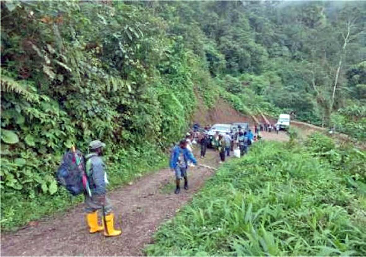
This photograph from an article by Bradley Mariori on the surveying of the Kabwum-Lae Road, published 2023 on the website of EMTV, https://emtv.com.pg/social-mapping-and-survey-effort-for-lae-kabwum-road-project/, accessed 24 October 2023.)
As for Hector, who now lives in retirement in Budapest, he undertook more Saruwageds trekking than I did. He tells me that sometimes his guides were reluctant to lead him where he wished to go. ‘Ples nogut, masta!’ (It is a bad place!) they would caution him. Wisely, he could accept that their intimate knowledge of their own territory was better than the best of maps and all the modern gee-whizzery of satellite-based navigational aids.
The hazards of the Saruwageds attracted worldwide media attention in August 2019 when 16 people from Lae died while attempting to cross the range. Their destination was Indagen, a village 60 kilometres north-east of Lae, 20 kilometres northeast of Mount Saruwaged and 11 kilometres southeast of Kabwum.
Those who died were members of several large parties on a pilgrimage from Lae for the centenary celebrations of the Lutheran church at Indagen, which has an airstrip, but the pilgrims had decided to walk rather than fly because they could not afford the fare. Becoming lost on the way, they variously died of cold, exposure, hunger and injuries they had suffered. With great difficulty, helicopter crews later retrieved their bodies.
These events led to demands for the construction of an Indagen-Lae road. The Morobe Provincial Government eventually committed itself to this project. The Morobe Governor, Luther Wenge, performed a sod-turning ceremony
at Indagen on 1 September 2023. He allocated two million Kina for plotting the route. A team of 32 surveyors, including volunteers from nearby villages, were at work on the ground by the end of the month. The National Government had pledged 100 million Kina for the project over ten years.
The survey team beginning work on plotting the route of what will hopefully one day be a road between Lae and Kabwum.
Whatever route is followed, constructing and maintaining a road across the Saruwageds will be a formidable engineering challenge.
Readers familiar with the history of road building in Papua New Guinea will be reminded of the famous Wau–Bulldog road of 1943. This was the army route from Wau south across the Central Ranges to Bulldog on the upper Lakekamu River. The Royal Australian Engineers constructed this 114-kilometre road, which included 17 bridges, in only four months. It was a stupendous engineering achievement but a white elephant.
Once completed, the Wau-Bulldog road was little used because the construction of the Nadzab aerodrome near Lae in September of that year rendered it redundant. Flying troops and cargo from Port Moresby to Nadzab was much easier, quicker and cheaper than sending them by road. The jungle soon reclaimed the abandoned road.
Part two can be found HERE.