Browse our Photo Galleries
Contributions are welcome and may be used in our quarterly journal. Please include date (approximate is fine), names and place. Permission to use photographs should be obtained from the authors or check with PNGAA. Following any approval to re-use photographs, both the photographer and PNGAA need acknowledging.
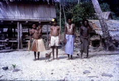
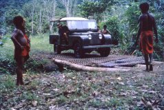
Following a few weeks in Popondetta and Wanigela, Jim’s first posting was at Bolubolu Patrol Post on Goodenough Island where he remained for 5 months. He then spent 14 months at Mapamoiwa on Fergusson Island, patrolling all the D'Entrecasteaux islands including Woodlark and the Trobriand islands. In mid 1966 Jim was transferred to Rabaul for further training at the then Malaria Institute. In January 1967 he was posted to Minj in the Western Highlands as District Malaria Supervisor, moving to Mount Hagen in 1969. September 1973 saw a posting to Kieta, Bougainville, as Provincial Malaria Supervisor. After six and a half years of extensive patrolling, Jim, in 1980, was transferred to Goroka in the Eastern Highlands Province and took up the position of Regional Inspector covering most of the Highland Provinces. Jim went “finish” in February 1985.
.....
The Amphlett Group consists of 14 islands and islets that are arranged loosely in a ring shaped formation of 21 km by 16 km with a further 5 islands located 3.5 km to the east, outside of the main ring. The islands are hilly, rising to 586 m above sea level on Yabwaia and to 457 m on Wamea. The main islands include Wamea, Wawiwa, and Yabwaia.
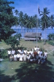
The following photographs were taken by Jim Van Der Kamp. Jim joined the PNG Public Health Department's Malaria Control Programme as a Field Officer in January 1965 after 18 months service in the Army as a Medico in what was then Dutch New Guinea (now West Papua) and a break back in Holland.
Following a few weeks in Popondetta and Wanigela, Jim’s first posting was at Bolubolu Patrol Post on Goodenough Island where he remained for 5 months. He then spent 14 months at Mapamoiwa on Fergusson Island, patrolling all the D'Entrecasteaux islands including Woodlark and the Trobriand islands. In mid 1966 Jim was transferred to Rabaul for further training at the then Malaria Institute. In January 1967 he was posted to Minj in the Western Highlands as District Malaria Supervisor, moving to Mount Hagen in 1969. September 1973 saw a posting to Kieta, Bougainville, as Provincial Malaria Supervisor. After six and a half years of extensive patrolling, Jim, in 1980, was transferred to Goroka in the Eastern Highlands Province and took up the position of Regional Inspector covering most of the Highland Provinces. Jim went “finish” in February 1985.
.....
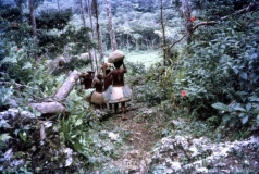
Fergusson Island is the largest island of the D'Entrecasteaux Islands, in Papua New Guinea. It has an area of just over 500 square miles (1,437 km2), and mostly consists of mountainous regions, covered by rain forests. There are three large volcanoes on the island. The island is situated 3 km across the Dawson Strait from Normanby Island and 4 km from Goodenough Island across Moresby Strait. The highest peak at 6,801 feet (2,073 metres) near Wadalei in the northeast of Fergusson Island of a extinct volcano. Seymour Bay is located on the west coast, Sebutuia Bay on the east, and Hughes Bay on the north. The principal settlements, Salamo and Mapamoiwa, are on the southern coast.
..............
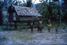
The Marshall Bennett group of islands are located in the Solomon Sea region of south-eastern Papua New Guinea and are situated between Woodlark Island (41 km to the east) and the Trobriand Islands (83 km to the west) and comprise Gawa, Dugumenu, Iwa, and Kwaiawata Islands. Gawa, the easternmost and largest island of the Marshall Bennett group, is an oval-shaped island of 5 km by 3 km. The island shows evidence of having been geologically uplifted in the past - probably a former atoll formation - the former reef rim now stands as a steep to vertical escarpment that rises to a flat-topped plateau (the former lagoon floor) within the interior. A narrow fringing reef surrounds the entire island. The Laughlan Islands are further west and lie to the east of Guasapa (Guasopa) on Woodlark Island.
Following a few weeks in Popondetta and Wanigela, Jim’s first posting was at Bolubolu Patrol Post on Goodenough Island where he remained for 5 months. He then spent 14 months at Mapamoiwa on Fergusson Island, patrolling all the D'Entrecasteaux islands including Woodlark and the Trobriand islands. In mid 1966 Jim was transferred to Rabaul for further training at the then Malaria Institute. In January 1967 he was posted to Minj in the Western Highlands as District Malaria Supervisor, moving to Mount Hagen in 1969. September 1973 saw a posting to Kieta, Bougainville, as Provincial Malaria Supervisor. After six and a half years of extensive patrolling, Jim, in 1980, was transferred to Goroka in the Eastern Highlands Province and took up the position of Regional Inspector covering most of the Highland Provinces. Jim went “finish” in February 1985.
.....
Normanby Island is the most southerly of the main islands that comprise the D'Entrecasteaux Group, being situated 3 km south of Fergusson Island from which it is separated by the Dobu Passage, and 16 km northeast of East Cape — the easternmost point on the PNG mainland — across the Goschen Strait.
Normanby Island has an irregular and elongated shape, measuring 73 km in length (northwest to southeast), is 28 km to 4 km in width and covers an area of 1,040 km². The island has a range of terrain types that includes low coastal plains and swamplands, high mountains (reaching 1,158 m) and steep coastal slopes. The eastern end of the island is characterised by north to south trending ridges and valleys that deeply dissect the landscape.
In 1873, the island was visited by British Captain John Moresby, commanding HMS Basilisk, who named it after the Marquess of Normanby, George Augustus Constantine Phipps, a governor of Queensland, Australia.

The images of these letters including a relevant newspaper cutting can be found in "Letters from a Hundred Years Ago : a tale of love and tragedy".
.....
The Trobriand Islands (today officially known as the Kiriwina Islands) are a 440 square kilometre archipelago of coral atolls off the eastern coast of New Guinea and lie in the western Solomon Sea. They are located 65 km northeast from the D'Entrecasteaux Islands and 132 km west from the Woodlark Islands and are part of the Milne Bay Province of Papua New Guinea. Most of the population of 12,000 indigenous inhabitants live on the main island of Kiriwina, which is also the location of the government station, Losuia. Other major islands in the group are Kaileuna, Vakuta and Kitava.
